CCO Hornsea
The civil parish of Hornsea (population 8432) is located on the Holderness coast approximately 16 miles (25 km) northeast of Hull. It is bounded by the civil parishes of Atwick to the north, Seaton to the west, Hatfield and Mappleton to the south, and by the North Sea to the east. The civil parish contains the coastal town of Hornsea, and a suburb of "Hornsea Bridge" or "Hornsea Burton" south of the former railway line, as well as Hornsea Mere. Most of the civil parish lies between 33 and 66 feet (10 and 20 m) above sea level, with the highest points in the parish under 98 feet (30 m). Hornsea Mere is a lake of around 1.24 by 0.62 miles (2 by 1 km) which outflows towards the sea by the Stream Dike Drain – the drain also separates Hornsea from the Hornsea Bridge suburb.
The underlying geology is primarily boulder clay. High points in the area are formed of gravel (see Moraine). The topsoils are fine and loamy, whilst the rock beneath the boulder clay is classed as Flamborough Chalk from the Upper Cretaceous period. Borings suggest the chalk probably lies at around 60 to 70 feet (18 to 21 m) under the sand, gravel and clay beds at Hornsea, though possibly deeper.
The Mere is the last of many lakes in the Holderness area – the remainder had been drained by the later 19th century. At the sea remains of a submarine forest were found in a bed of peat around halfway between cliff and lower water. The trees were identified as oak, alder and willow. A variety of fossils have been found in the deposits, including those of the extinct Eurasian cave lion (Felis spelaea), Wooly Mammoth (Elephas primigenius), Aurochs (Bos primigenius) as well as Red Deer (Cervus elaphus) and Horse species (Equus). Molluscs found in the subterranean gravel appear to have been freshwater species. It is thought the source of the submarine forests recorded on the coast at Hornsea may have been a second mere on the eastern side of the present lake which was silted and was lost to the sea at some point.
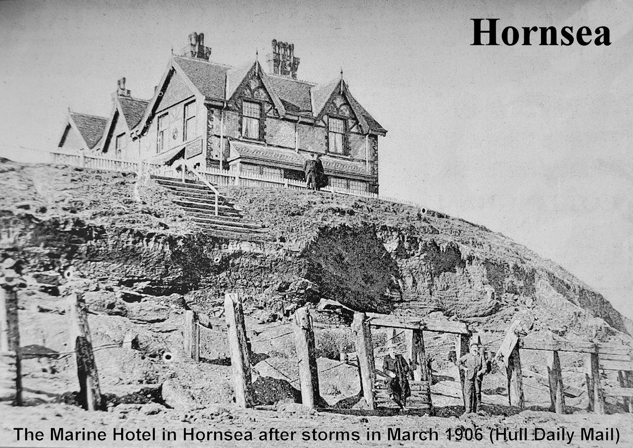
The coast at Hornsea is subject to erosion. The rate of erosion varies, but has been inferred at around 4 yards (3.7 m) per year in the later part of the 16th century; estimated by George Poulson at 2 yards (1.8 m) per year in the late 18th century, though recorded at up to 6 yards (5.5 m) in some years in the same period. The rate of erosion may have been influenced by the presence or absence of erosion limiting groynes or a pier. South, at Hornsea Burton, erosion rates rose from 1.3 to 5 yards (1.2 to 4.6 m) pa between the periods 1845–76 and 1876–82, thought to be due to the construction of groynes north of the beach at Hornsea. The current (2008) rate of erosion is 1 foot 8 inches (0.5 m) north of and 6 feet 7 inches (2 m) south of Hornsea – the difference due to the defences at Hornsea preventing the renewing flow of sediment southwards.