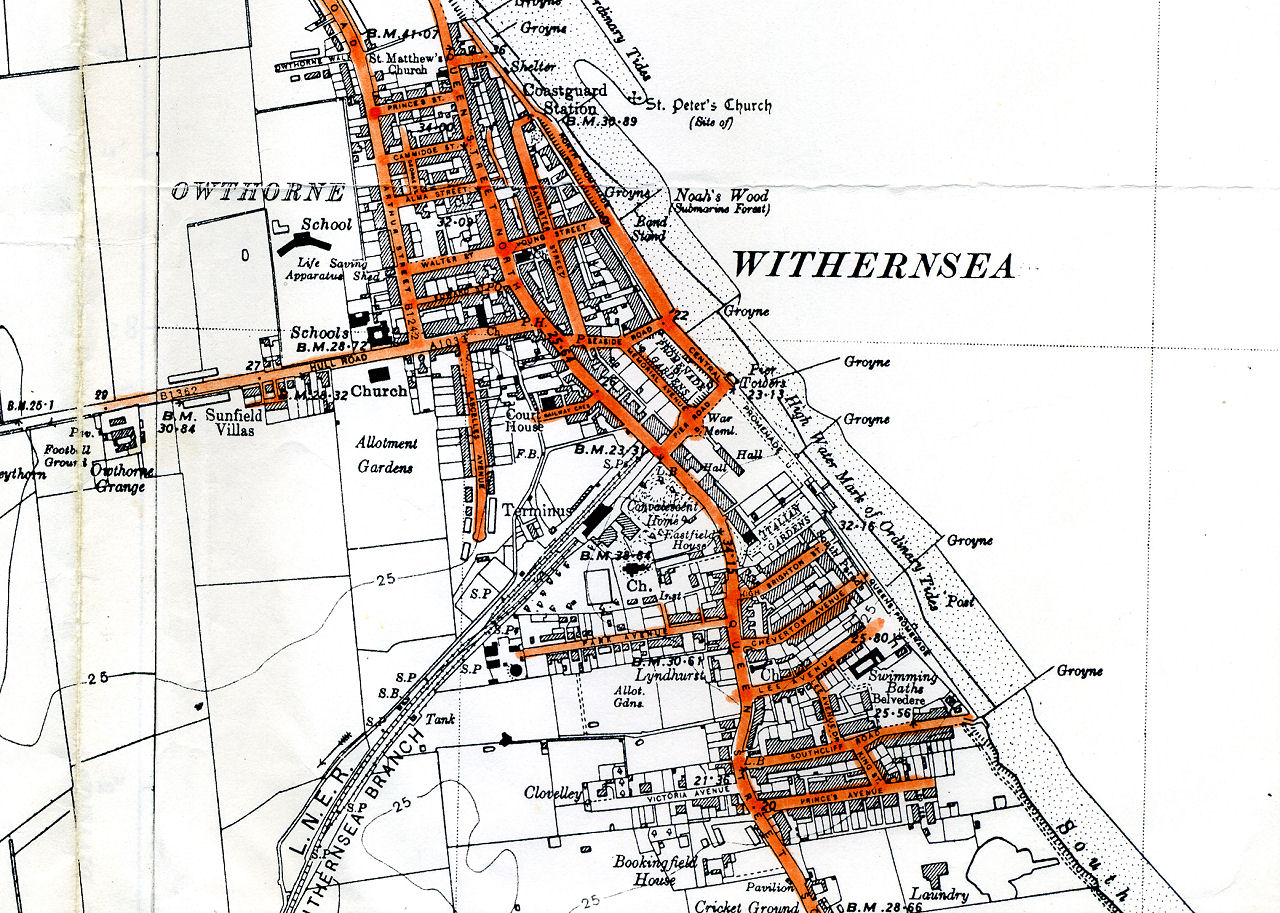
Historical Maps
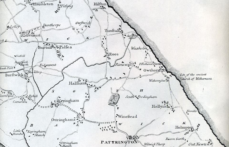
Map of Holderness in 1786. Notice how Withernsea is just an insignificant little village, Pattrington and Hedon being the two main towns in the area.
Click on the maps for large versions.
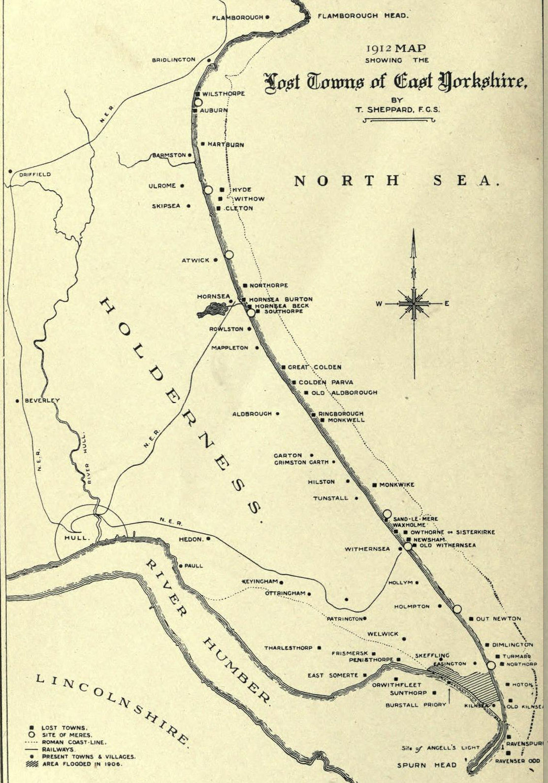
Map from 1912 showing the lost towns of East Yorkshire and where the coastline was during roman times (43 to 410 AD)
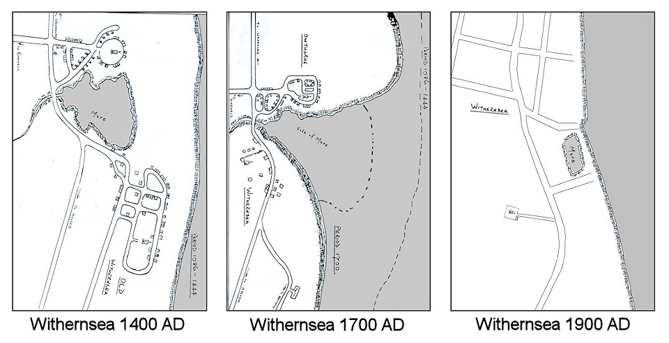
The above maps show how Withernsea Mere has developed over the centuries as the coast line receded.
In 1871, beach groynes were built at Withernsea to protect the town from the costal erosion.
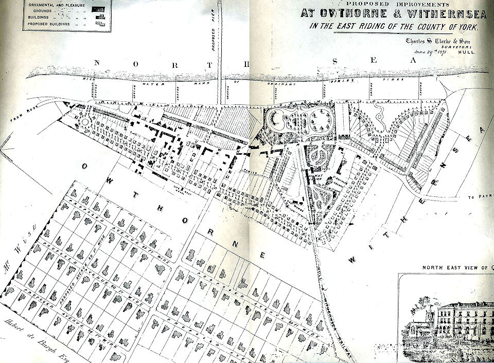
Proposed plan 1871 of Withernsea by the Withernsea Pier, Promenade, Gas and General Improvement Co LTD.
Click on the map to see a more detailed full resolution map.
Notice that the pier was originally planed to be at the end of
Young Street, but was later built further south.
The parish boundary between
Owthore and Withernsea can be seen along Seaside road, and then along the railway line.
Also note the original location of the Life Boat House on
Arthur Street.
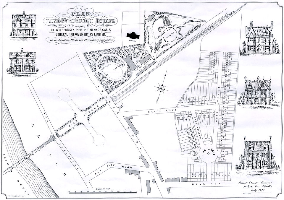
Proposed new development of Withernsea by The Withernsea Pier, Promenade, Gas & General Improvement Company in 1878.
Excisting building in grey. Town Street is now Queen Street.
The grand West Avenue housing estate was never built, and many years later was to become Lascelles Avenue.

Map of Withernsea in 1856, just 2 years after the railway line opened.
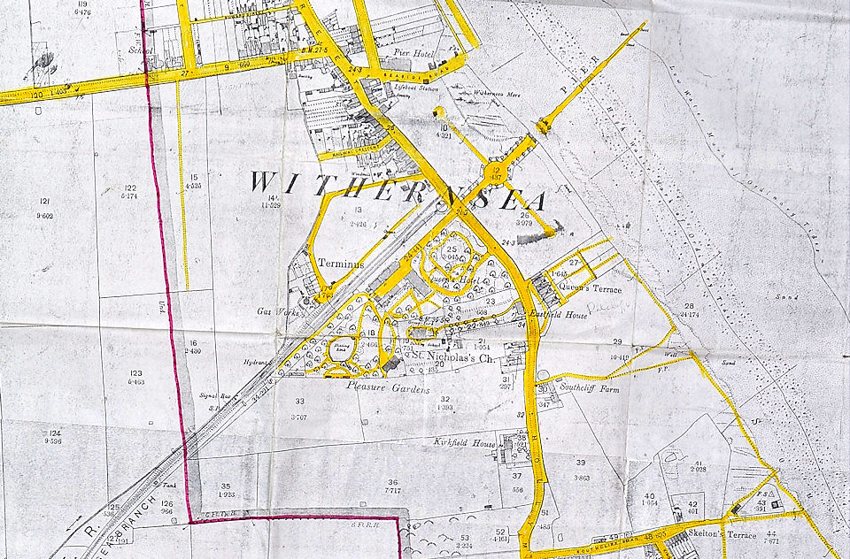
Map of Withernsea in 1890. Click on map for large version.
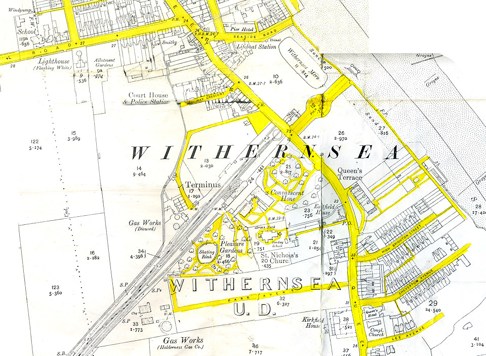
Map of Withernsea in 1910. Click on map for large version.
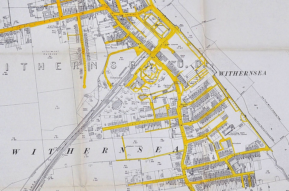
Map of Withernsea in 1927. Click on map for large version.
Map of Withernsea 1938. Click map for large version.
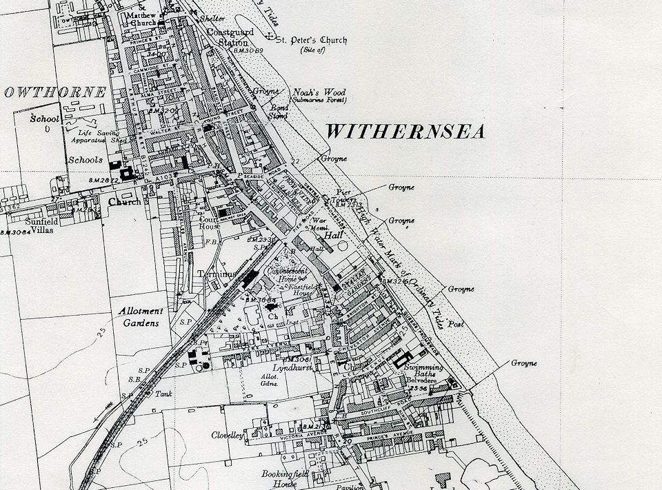
Map of Withernsea in 1946. Click on map for large version.
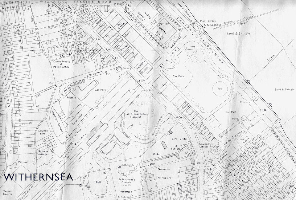
Map of Withernsea in 1972. Click on map for large version.
